产品介绍
MODIS全球500米植被聚集指数产品(包括8天、月、季度三种时间分辨率的产品)。
数据说明
1. 数据空间范围(北京市,京津冀,全国,全球,特定地区)
全球
2. 数据时空分辨率,时间跨度
空间分辨率为8天、月、季度,空间分辨率为500米,时间范围为2000-2020年。
3. 数据类型(矢量、栅格、图片等)
栅格
4. 数据源说明
本数据主要基于MODIS BRDF/反照率产品(MCD43A),以及MODIS地表覆盖类型产品(MCD12Q1)通过算法计算得出,上述输入数据下载于网站:https://search.earthdata.nasa.gov/。
5. 数据精度
利用全球地面数据进行验证,主(备用)算法的精度为R2 = 0.80(0.72),RMSE = 0.07(0.12),bias = -0.03(-0.10)。
6. 预计数据量(MB,GB)
8天数据:1011.7G;月数据:296.85G;季度数据:100G左右;总共1408G左右。
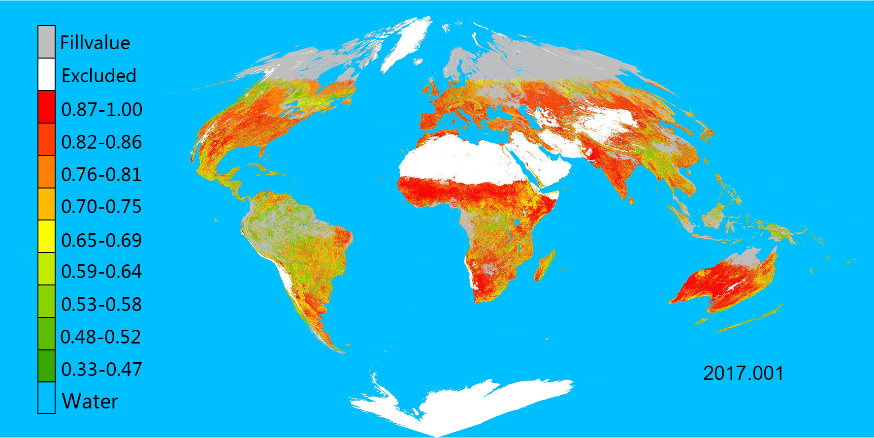
影像展示
产品文献
[1] Jiao, Z., Dong, Y., Schaaf, C.B., Chen, J.M., Román, M., Wang, Z., Zhang, H., Ding, A., Erb, A., Hill, M.J., Zhang, X., & Strahler, A. (2018). An Algorithm for the Retrieval of the Clumping Index (CI) From the MODIS BRDF Product Using an Adjusted Version of the Kernel-Driven BRDF Model. Remote Sensing of Environment, 209, 594-611
[2] Dong, Y., Jiao, Z., Yin, S., Zhang, H., Zhang, X., Cui, L., He, D., Ding, A., Chang, Y., & Yang, S. (2018). Influence of snow on the magnitude and seasonal variation of the clumping index retrieved from MODIS BRDF products. Remote Sensing, 10, 1194
[3] Jiao, Z.T., Hill, M.J., Schaaf, C.B., Zhang, H., Wang, Z.S., & Li, X.W. (2014). An Anisotropic Flat Index (AFX) to derive BRDF archetypes from MODIS. Remote Sensing of Environment, 141, 168-187
[4] Jiao, Z., Schaaf, C.B., Dong, Y., Román, M., Hill, M.J., Chen, J.M., Wang, Z., Zhang, H., Saenz, E., Poudyal, R., Gatebe, C., Bréon, F., Li, X., & Strahler, A. (2016). A method for improving hotspot directional signatures in BRDF models used for MODIS. Remote Sensing of Environment, 186, 135-151